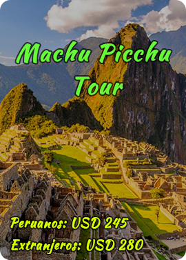
Description Set Machu Picchu
The magnitude of the set will be appreciated divided into two distinct areas that give us a clearer and perfect layout of its urban layout idea.
Demarcation of the archaeological site
A. Agricultural Sector:
The agricultural sector, to understand and study best we separate it into two areas.
A.1. Superior Agricultural Area
It is what is the current access road, middle up, composed of a series of agricultural terraces. At the top of a small square, misnamed “The Cemetery”, in reality this place is nothing more than an agricultural ceremonial sector, which is virtually littered with countless stones, which would be related to the legend of the Purun is Aukas or called “stones Guerrero”. In this square, in front of a construction which is called “the upper guardian” which is nothing more than a utilitarian building type Wayrana or Masma (inka building three walls) lies; then, almost in the middle of the square, a rock is carved called “The Rock Funeral” and which give different functions always related to funeral rites and that it is actually nothing more than a ceremonial altar of agricultural character. In the background there are several buildings that are Qolqas or large deposits. Then they follow a series of agricultural terraces usually called by the name of platforms, but a lot of them are covered with vegetation.
A.2. Agricultural Area Lower:
It is located at the bottom of what is the current access road to the citadel.
In this sector, constructions called “The Guardians Inferiores” are. But in reality these buildings were residential or farmers housing sector; well there is still a lot of terraces, at the bottom, covered by vegetation. We should clarify that the land filling of these agricultural terraces is vegetable humus and a lot of this land was transported to another place and located in these terraces.
B. Separation of Agricultural and Urban:
The separation of the area or agricultural sector in the urban sector is made up of two elements: one is a drainage ditch and the second element is a staircase that descends along the wall and terraces.
C. Roads:
Because of that Machu Picchu is located on the top half of a mountain, it seems to be inaccessible or only accessible by roads that extend along the profile or contour of the surrounding mountains, but is known from studies, this urban center was linked to other centers, major or minor, by an intricate road network, not only by the high parts of the mountains but also by the lower parts of the valley; so we can see that there are still traces of a visible inka way from Huat’a in the Pampa de Anta. For the initial examinations by Paul Fejos, in the area of Machu Picchu fragments of one of the many Inca roads sector, road was covered with a layer of soil and vegetation were found. Currently, several paths are known in this area, many of them are attached to the slope of the mountain and have staircases, bridges and tunnels. Today is very visible the road leading from the top of Machu Picchu transposing the mountain pass Intipunku, where there is an Inca construction, this road passes by the area of the top farmers and gives the gateway the city and at the same time is attached to the steps. So there is also a deviation or ramification of this at the top going to inka bridge which is another way sector.
Keep in mind that during the time of Quechua State, there were various types of roads, according to the territorial division of the State policy also was exceptional road planning, which will appreciate in another paragraph; we must not forget that the Inca roads were paved with stone tiles or cobblestones.
D. The Wall Beltway
The city of Machu Picchu, in almost all its perimeter is surrounded by a wall or walls of 180m more or less thick and 4 to 6 m. lifting in many places is intact and appreciates it, especially in the area where the city has increased accessibility as in the sector of the pit, facing Qolpani, ie below the qolqas or barns.
It is logical that in assessing this fortification wall, is think of an element of defensive military character, we can not flatly deny this hypothesis, but actually this wall was mostly a character of social control, ie to prevent uncontrolled movement of people; the fact that it found mainly in areas easily accessible is the reason that these sectors would be the points of entry or exit of people in an uncontrolled manner and walls that rose in these sectors.
E. The entrances to the city:
Access to large urban center of Machu Picchu is given by two clearly defined places in the top where is the main entrance and in the middle part where a path between terraces overlooking the middle of the sector is seen the sources.
F. Cemetery:
This place misnamed as the cemetery is south of the city, on top of higher agricultural sector and in the bottom of the hillside, Wayruro. The specific area as a cemetery is more or less a wide square where a lot of stones (boulders) that the river were transported to that place is; excavations in this area was found some human remains were made, but in reality cemeteries were shown to Bingham in 1913, in the mountains of Waynapijchu, being in fact this esplanade a ritual dedicated to agriculture industry.
The existence of the large amount of transported river stones, which are boulders, it is very likely that relate to the legend of the Purun Aulcas or called the legend of the warriors stones, to understand this we have to mention the following, which during the revolt of the Chankas the battle Ichu Pampa or Yawar Pampa (now the pampas of anta) among the Quechua and chankas, so what Pachakuti Inka Yupanqui has the famous dream of Pachayachachiq God in waka Susurpukio was fought located in the area Ch’itapampa sector, and that vision know that the stones of the plain of Anta would become warriors and thus defeat the Chankas. According to this legend, in the crucial moment of the battle, the stones became warriors and chankas were frightened and fled in terror; for this reason the Inka- ordered Anta stones were spread across all the geographical scope of Quechua State. For this fact, reported in several chronic, we believe these stones are related to the legend of the Aukas Purun.
G. The Sacred Rock:
In the central part of the aforementioned square, a lytic block is irregularly shaped and measures about 4 m long by 2 m. high, also has three steps and in one end a loop or ring; this element accuse him as the funeral rock, which yielded place in the last tributes to the deceased, where the mummified also be a series of musings on funeral rites say. But in reality and according to them and how it relates, is a ceremonial altar dedicated to agriculture, is sufficient proof of the existence of three rungs or steps, an element that determines the sign called Pata-Pata, which is the representation of marriage or the relationship between the concepts of land or possessing the Quechua worlds.
H. Since higher Surveillance also called the House of Ayakamayoq:
The so-called lookout or house Ayakamayoq is composed of a building of three walls (Room in Wayrana or Masma), with several windows, its position suggests that this compound clearly acted as control and surveillance, since from this instead easy control of road media exerted place.
This same building will house Ayakamayoq called (manager of the dead), ie the house manager of the dead or the cemetery. This arises based on the idea that this sector is the cemetery.
But we must make clear that this construction was mostly a function of character purely utilitarian and functional being neither surveillance point, no house guardian of the cemetery manager of the dead, as this position is taken by those who have a sense of traditional character and not doing a more critical and social approach.
H.1. Lower the Post-Sector Monitoring or Call of the Lower Guardian:
The so-called post lower surveillance or lower guardians, is composed of a series of buildings arranged in staggered restored mostly ceilings armazuelo with sotechado of tied straw, enclosures large doors and windows, as, at present, are in the way of access to the archaeological site of the city, suggests that these areas because of its location fulfilled the role of monitoring and surveillance since from this site can exercise control access to the city. But we must make clear that this set of buildings is located in a sector of road but on the side and central area of agricultural terraces sector therefore is determined as a set of rooms for households of farmers, so they can be referred to as the neighborhood farmers.
I. Dubbed the Funerary Rock Rest:
Before accessing the latest steps that lead to ceremonial plaza agricultural sector, granitic rock outcrop, which many refer to as a sector of rest for transporting the bodies to the cemetery is. But in reality, it is a rock that had a utilitarian function within the traffic system as a break, as we should stick more to social and logical aspect that had been Quechua organization, functioning society par excellence. Well we can not exclude possibility that it is a sector of Messa Mastasqa, or an altar or ceremonial sector for the placement of offerings for payment to the land.
J. City or Urban Sector:
Urban concentration of Machu Picchu is not an architectural and construction conglomerate anarchic character without any planning or where the inhabitants made or raised their homes at will and self-determination. On the contrary, the city of Machu Picchu is a clear example of urban planning micas cities, the urban-architectural study applied to social service, which we see in a very clear way the arrangement of neighborhoods (kanchas) inkas, of streets (q’ijllus), squares (pampas), therefore appreciate a clear criterion of urban study. So we refer to the description of the city, dividing it into sectors to provide greater understanding of this.
J.1. The Home Access:
The Inca Trail descends from the top of the mountain through the upper agricultural sector, leading to the main entrance of the urban sector called Intipunku (Inti – Sun; Punku = Gate), which has a monolithic lintel; on the inside and top of the door, a lytic ring nestled in the middle and upper lintel and side and middle parts of the jambs two trunks with few lyrical lines, which have now been fixed with cement is appreciated, but initially they spun on its axis and which are elements of the system of the door giving access to a neighborhood and the urban part of Machu Picchu.
J.2. Military Neighborhood:
known area according to traditional theory, as a neighborhood of housing for servicemen or a housing area devoted to them. But if this sector is appreciated, we shall see, there are three sets, completely separated from each other, each with a completely independent access. For studies such as: excavations, restoration and research, walls coated with mud painted with ocher and cream, pottery shards Chimu, fragments and sleepers burned roofs and in one of the enclosures a lytic table found were found, by associative elements batán appreciated that served to grind clay, the raw material for the production of ceramics. Thus, this neighborhood is a housing estate of functional and utilitarian, ie living rooms, workshops, warehouses, etc., and it was not a neighborhood or housing complex for the military.
J. 3. The Barrio de la Nobleza
As in all cities Inkas, it is divided into two parts (upper or Hanan and bottom or Urin) and then two (left Phana right, lloqhe y) which added to the previous division gives four, Machu Picchu not is outside this rule and is divided into two and four; thus it has an upper and lower section (Solar and Lunar), each with an area called district of the nobility really, in this case, is a multifunctional set ie consists of housing for the nobility, a sector administrative and religious sector; is actually the taqe, union or central point, the conjunction of Tawantin of Machu Picchu, so we have the following distribution:
J. 3.a. The Housing Complex:
An area of housing rooms for individuals who lived in this sector, as called Ñusta Palace and the royal Housing or Regios Palacios; we must clarify that when mentioned palaces, with the Western idea we immediately think of pageantry, wealth, luxury, etc .; but called palaces inkas must be understood from another perspective, ie as architectural constructions of a better finish, but always more utilitarian character and not with exuberant decoration (painting, sculpture, engraving, etc.). Whereby:
J.3.b. Palace Ñusta:
Construction of two plants, generally referred Ñusta Palace, but this designation can not be proven scientifically, so to say Ñusta palace is only hypothetical. Actually, it would be a home, possibly important, dedicated to a governor (a term we use to determine the ruling or commanded in this town) of Machu Picchu and housing at the top would be dedicated to a priest, by proximity to called military tower, which in reality is a construction with a different function from that discussed in a separate paragraph.
J.3.c. The Regias Housing:
As the name suggests would be the royal dwellings. But if we judge from a more ethnoarchaeological or ethnohistoric view and observing in detail the study of urban planning of the Incas, we appreciate the functional versatility of the buildings on many occasions, in this specific case would homes and an administrative sector.
J.3.d. The Royal Tomb:
The so-called royal tomb, is a building where walls and carved rock in situ and used for this construction is semi semiartificial and appreciated. It can be seen on the walls of this sector a series of trapezoidal niches; in situ rock has been used for the roof, the outer wall, the floor and the base of the upper construction. This is called Royal Tomb because it is thought that in this place important burials were made, so it is said that there is a sacrificial altar table or inside. But according to the judgment of the Ethnoarchaeological research and etnohistórica this group or unit is of ritual character or a ceremonial place, that is a temple dedicated to the land and the altar is in the interior, which is called a place sacrifices, is nothing more than a ritual altar dedicated to land and niches have characteristics of ceremonial function, on the outside, there is a carved this lithic outcropping element in which the step sign seen in three levels, which represents to land and that in the Andean world is known by the term Pata pata, this means in the Andean ideology link between the land.
J.3.e. Military Torreon:
This building was originally encompassed call this way according to a criterion and Western thought, which conceived to by the type of construction and location it was a place that had military purposes. This construction is erected on the top of the lytic natural outcrop used for the construction of the so-called Royal Tomb. Part of the walls and the walls of this misnamed Military Torreon are an amazing precession and a carved exquisite, are lytic isódomos settlement dry, kind of architecture that belongs to the so-called Inka Inka Classic or Imperial.
Research and parallel study of ethnohistory and ethnoarchaeology make the assumption Military Tower crumbles as if we appreciate the buildings of Cusco Qorikancha or construction Intiwatana called P’isaq, we see that are similar to the buildings of Machu Picchu, It is actually a ceremonial building-religious character; would become the Qorikancha city of Machu Picchu, and is referred to as the Intikancha (Inti = Sun; Kancha = Quarter), ie, the Sun Temple, although it should be clear that the sun was not the Supreme God of the inkas but this was the God Apu P’unchao, also called Pachayachachiq, so this would be the temple construction Maker and Supreme God of the Andean people.
Element worth mentioning is that this construction has been studied in the field of archeoastronomy and has seen and determined that not only possessed a ritual function but was a place of study and astronomical observation.
Characteristic has a series of trapezoidal niches blind and well trapezoidal two windows, which, on the outside, have four lytic prominences.
Also, there is a large window facing the “Waynapijchu, call Sierpes, at the bottom of this window to the outside a series of holes that possessed a utilitarian seen (this type of window holes can be seen in the Cusco, throughout the Qorikancha, in one of the inner construction thereof).
In the central area of the construction of this misnamed Military Torreon, a rocky outcrop that belongs to the rock in situ that underpins construction, which has been carved outcrop, serving as ceremonial altar table or appreciated. Many people say c indicates that it is a sacrificial altar, big mistake, because it is based on the construction and placement of objects offerings paraphernalia of rites; as well as studies archaeo-astronomy, this element is related to the astronomical function that also had construction.
J.4. The sources:
They are in number of 16 are visible which, other as those discovered in the bottom. Machu Picchu (in the urin sector), are located in various successive levels, all interconnected by channels using the siphon system or communicating vessels, although usually they are given a ritual function, 98% are of utilitarian nature .
J.5. The Ceremonial Source:
This is the second of the sources that is next to the main temple, it stands by him finish lithic blocks used in its construction.
Source for its position and the fineness of its preparation makes see that it is a ritual element, that is a temple dedicated to water, which would be a repeat of Tambomach’ay building, which is a temple water (parallelism architectural), ie its function outside the utilitarian characteristic it would also be religious characteristic.
J.6. The Masma or Wayrana:
This is a construction of three walls, it is considered by many as a building dedicated to rest, but their position and area ratio shows that this was a ritual character, possibly was directly related to the liturgical source. We are not sure that it has been a construction related to water rites, which assure itself is the ritual character of this building.
J.7. Las Canteras:
It is a sector of lithic outcropping known as quarries. As is logical for the formation of this company, this was extraction point lithic material.
In this place, a rock with several holes that follow the mirror diaclasa and on one side is seen as a separate block this fragment is given by the system of wooden wedges shown. Usually this block is presented as a source element Inka, but in faith to the truth must clarify what this block is neither was Inca origin but was worked and presented in this way by Mr. Eulogio Cabada and Manuel Maduro (Engineers) in 1953.
Work done to show the technique of rock fracturing used by the Incas for the extraction of stone in quarries; another element that draws attention are the remains of a circular construction, which give various functions, but in reality, by location, this construction is utilitarian.
J. 8. The Religious Sector:
Following the quarrying of religious sector, which is composed of four buildings and some special lytic is. Is a group of buildings related purely religious functions, so this set is broken down as follows:
J.8.a. The Main Temple:
It is located in the northwest sector of the set and facing east and southeast. This is a construction in masma or wayrana ie three walls. This religious sector is known as the Sun Temple. Often a clear explanation is not given because he says Temple of the Sun, there, to clarify that in the period Inka sun was not the most important or principal deity of broad religious pantheon of this town, its conception was more closely linked with the concept of light. This construction is isódomos blocks elaboration and surprising recess, the feature is that are lytic blocks elaboration and surprising recess, the characteristic is that they are semimegalítico character and the upper portions are small, observed, this Thus, the great technical study of weight distribution and load on the construction. The building has several trapezoidal niches that are arranged 5-7-5 (5 on each side facing the front and 7), making recesses 17 in total; niches above a lithic nails are appreciated. Out of all this, we can see at the bottom of the front face three lytic of considerable size, the plant, which is the largest of 4. 30 x 1, 50 x 85 m. This block is the ceremonial altar of the temple and the two small blocks are secondary or accessory elements of the main altar tables for placing objects that were used for the paraphernalia of rites performed therein.
J.8.b. The Temple of the Three Windows:
Construction of masma type or wayrana, three walls, although this is a small difference in the front, where there is no wall, a lytic pillar for supporting the lower roof beam along this column shown a block is lytic which is carved the stepped sign. The physical element of the presence of the three windows, it is directly related to the symbolic-ideological trilogy religion of the Andean world such as:
Centella-ray-thunder.
Sun-moon-stars.
Puma-snake-condor.
That is an element that is purely symbolic-ritual architecture.
The traditional theory tells us that this was the place of departure the Ayar brothers to found the Empire and Cusco, a fact that has no physical relationship with the archaeological site of Tamp’utoqo or the Pakarijt’ampu, rather than according to oral tradition and the data provided in the chronicles came out the four brothers Ayar; You can not deny that the site of the temple of the three windows does not have an ideological and symbolic relationship with the three caves which came the Ayar, it is perhaps because previously not performed and only wanted to find the physical element, since it would actually a memory element reminiscent ideo-collective, which would be the memory of origins.
In conclusion, we say that besides the three windows has two blind trapezoidal niches, giving another idea which would be linked more to the ideological relationship of memories of origins. It is therefore a construction also linked to the trilogy and it is asserted even more for the reason of the existence of lithic having the stepped sign sculpted, what is clear representation of Andean thought, since the step sign is the representation of so-called paw-paw.
J.8.c. The Priest’s House:
It is a construction of cell walls that are character type of irregular polygons with mortar settlement, in front of the main temple. This designation Priest’s House is too sharp, so we must in this case be more logical therefore, do not deny the possibility of a home, but also could have been a construction of ritual character and utilitarian nature, ie a deposit.
J. 8.d. The Stone of Rites or Ceremonies Rock:
This is a large block that is in the angle of access to the square of the temples. It is indicated that this large block was a ritual shrine, a sacred rock, which were carried out certain religious rites related to the sector, as were offerings, sacrifices, etc.
This assumption can, in a very easily be disproved because you can see that this rock has not been finished work (styling), possibly belonged to an outcrop of the site, which was cut and the fragment exploited; another very clear element is that the block is supported by a series of small lithic fragments way. wedges or as a bed, so it is appreciated that lytic was being transported.
Therefore, this block should have been devised to another function and should be prepared to have another location and not the one that currently owns it is clear that as citywide new constructions were carried out and the sector appreciate certain traces of new foundations lytic so this should be part of a constituent element for a facing of a new building.
J.8.e. Semicircular basis:
In the opposite of the so-called stone rites angle, are the foundations of what was once a construction of semi-circular features, which many had features of a checkpoint, but the way of building partnerships with other buildings and the position was a ritual building features.
J.8.f. The Lítico Romboidal:
This block of rhomboid character is located between the Main Temple and the foundation of the semicircular construction, exactly at the extreme angle of the right hand (diagonal to the observer). This lytic has a rhomboid shape so striking, the general hypothesis that arises is that the position, shape and arrangement having is related to the location of the Southern Cross, called by the Quechua (Incas) with Chakana name, the Incas possessed a vast astronomical knowledge and his studies were very deep in this area. But so far their evidence in this specific case, it is only an assumption.
J.8.g. Room Priests also called Temple of the Stars:
Building is in the back of the main temple. Its walls are made of ashlar lithic rectangular or rectangular type isódomo. It also has, attached to the rear wall, a sort of socket or pin stone covering the entire length of the room, also at the socket or pin, incisions are appreciated by way of drainage channels. Finally, this construction has thirteen trapezoidal niches and a monolithic-that lytic has over 20 angles.
Because of these characteristics and also for the type of construction and location of it, it was related to ceremonial rites, although we can not say that kind of rite or ritual was dedicated.
J. 9. Intiwatana:
To access the top of a staircase is used; which is behind the construction of the so-called Temple hall of stars. Place that is located on a natural and artificial lift, which was developed as a truncated pyramid at the top. We can still see the remains of walls, which give us an idea of the existence of some related to all buildings. The element that gives the name to this place is in the middle of a small square, is carved on a regular forms in situ rock and in its central part has a bulge upright; this element usually call it or determine as a sundial, as it is said that the shadow cast by this projection or central nail determines the hours and also matched the shade with certain specified points of the rock, which had connection with certain religious celebrations. But in reality, the so-called Intiwatana is a lytic gnomon that stands at the top center of this truncated pyramid and which in ancient times was used as an element of astronomical observation, and precise division of the annual time. The central prominence was related to their angular projections with other elements;